Station Base Report
 Used to create a report that
contains station offset data for selected horizontal geometry elements.
Used to create a report that
contains station offset data for selected horizontal geometry elements.
You can access this tool from the following:

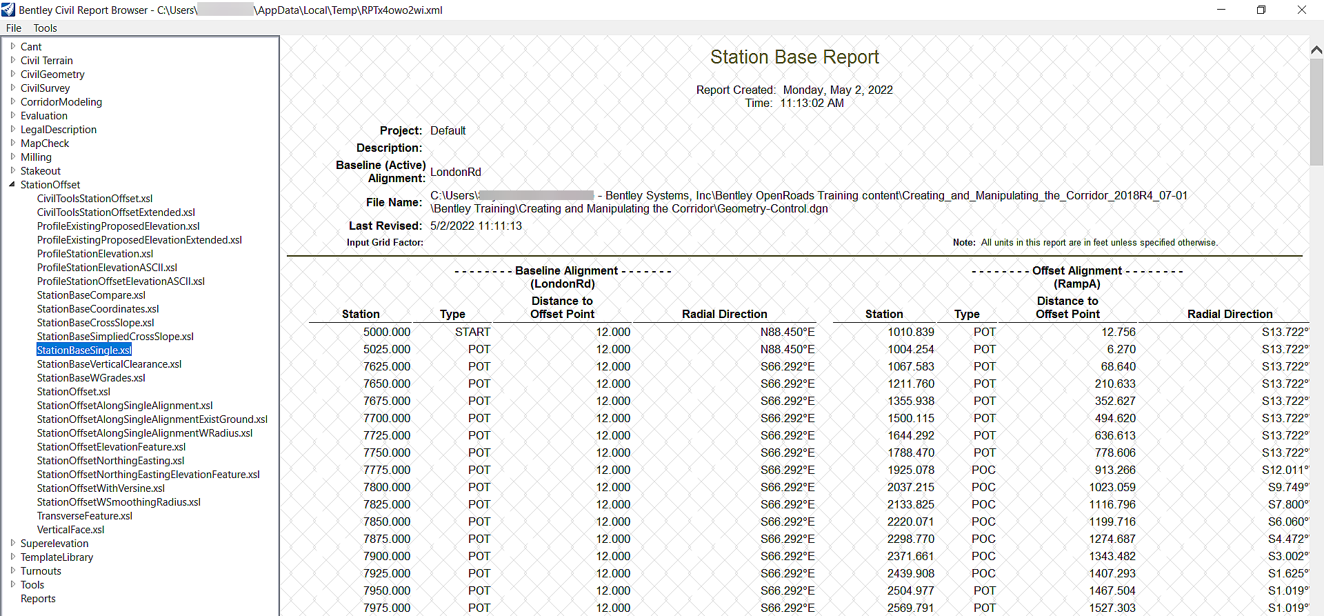
This report creates a report that contains station offset data for selected horizontal geometry elements. Offsets are always measured perpendicular from the base element to the offset element. The reported stationing is measured along the base element. Offsets are given for cardinal points on the base (non-offset) element.
Interval (optional) defines the distance along the base element between each measurement of offset. A value of zero has no effect.
Offset (optional) causes offset distances to be measured to a point that is not directly on the base element but rather is offset by the distance specified. A value of zero has no effect.
This report will also create a report called StationOffsetEleveationFeature.xls that also contains Elevation data for 3D alignments, 3D corridor elements, 3D Survey Linear features and 3d MicroStation elements.
1. Select the Station Base Report tool.
2. Define optional Interval or Offset in the Tool Settings.
3. Follow the heads-up prompts:
|
Prompt |
User Action |
|
Locate Element |
Select a civil horizontal geometry element (referred to as the base element above). |
|
Locate First Offset Element |
Select the civil horizontal geometry element to compute offsets or Select a 3D element (In 2D Plan View select: Survey Linear feature, another alignment with profile; In 3D view select any corridor element) |
|
Locate Next Offset Element |
Reset to Complete Continue selecting elements. Once all elements are selected, click RESET to generate the report. |
4. After the last prompt is completed, the Civil Report browser opens with the generated report. Note your report may look different depending on what report is selected as the default. See the Civil Report Browser for printing, etcetera. Select report StationOffsetEleveationFeature.xls in order to get offset and elevation from a 3D element
See Also